Driving along Highway 17 from Sault Ste. Marie to Thunder Bay, this stunning 703-kilometer route isn’t just the crown jewel of the Trans-Canada Highway—it’s an immersive journey combining natural wonders, Indigenous culture, and historic landmarks. After personally exploring this route, I discovered 18 essential stops, each with its own unique charm. Many of these hidden gems often go unmentioned in typical travel guides! From the spectacular Chippewa Falls and mysterious Agawa Rock Pictographs to the iconic Wawa Goose, every destination offers unexpected delights.
What makes this route truly special is how it perfectly showcases the pristine wilderness of North America’s largest freshwater lake. You’ll traverse Ontario’s largest provincial park, experience world-class wilderness hiking, and immerse yourself in rich Indigenous cultural history. Whether you’re a photography enthusiast, outdoor adventurer, or someone seeking spiritual rejuvenation, this route delivers an unforgettable experience. Consider staying at provincial park campgrounds or small-town motels for both economy and proximity to nature. Some attractions like Agawa Rock require admission tickets, so plan ahead and book accommodations in advance to fully experience this world-class scenic highway’s unique appeal.
Table of Contents
📍 Essential Guide to Highway 17 Along Lake Superior
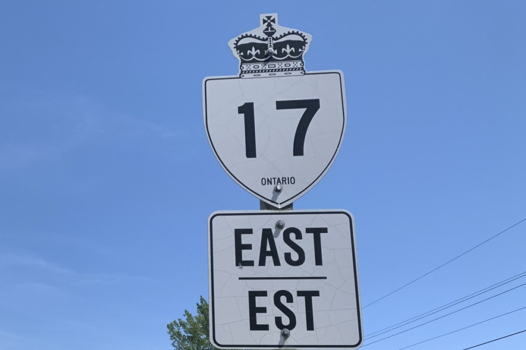
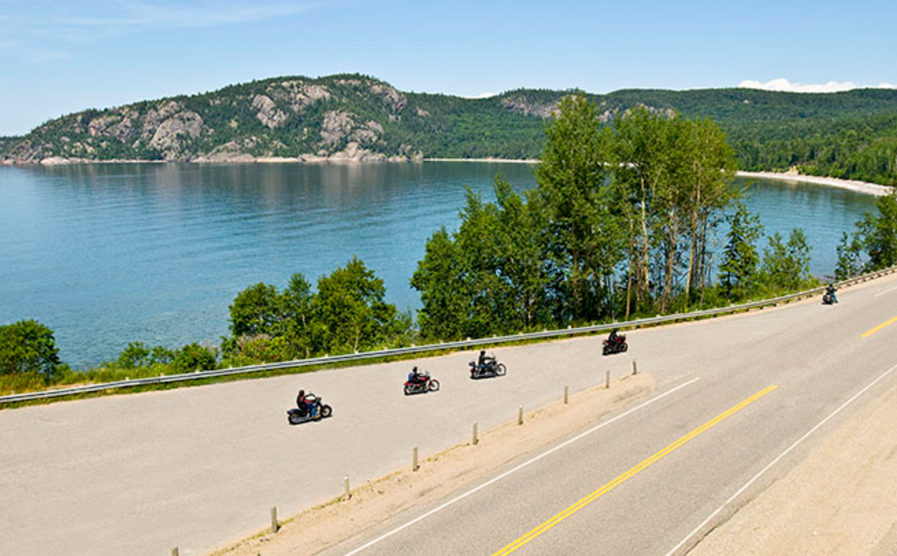
Highway 17 along Lake Superior is one of the most iconic segments of the Trans-Canada Highway. Stretching approximately 703 kilometers from Sault Ste. Marie to Thunder Bay, while the straight-line distance is only about 424 kilometers, the route hugs the lakeshore with sweeping curves and magnificent scenery, making it ideal for an in-depth road trip experience. We recommend allocating 2 to 7 days to fully enjoy all the natural and cultural highlights along the way.
Road Conditions and Driving Tips
- Most of this highway consists of two-lane roads with four lanes only near major towns. When encountering large trucks, exercise patience and wait for safe passing opportunities.
- According to the latest 2024 official information, most sections maintain a 90 km/h speed limit and have not been increased to 110 km/h. Speed limit increases have primarily focused on Southern Ontario’s 400-series highways, while the Lake Superior section retains its original limits—pay close attention to signage.
- The Ontario government continues to invest heavily in improving northern highway infrastructure. While overall road conditions are good, the terrain features many curves and elevation changes. Winter months (November to March) often bring heavy snowfall and ice, creating significant driving challenges. Always check real-time road conditions and assess your capabilities before traveling.
Gas Station Distribution and Refueling Reminders
- The most critical section is between Pancake Bay and Wawa—approximately 150 kilometers with absolutely no gas stations. Fill up at Pancake Bay or Batchawana Bay before departing.
- Other major refueling points are located in Sault Ste. Marie, Wawa, Marathon, Terrace Bay, Nipigon, and Thunder Bay. Some small-town stations have limited operating hours, so plan accordingly.
Communication and Navigation
- Only major towns have reliable cell service along the route; most sections have weak or no coverage. Strongly recommend downloading offline maps before departure and consider carrying a satellite communicator for emergencies.
- Ontario officially recommends using the “Ontario 511” app to check real-time road conditions, weather, and construction information, enhancing trip safety.
This route is renowned for its pristine nature, rich culture, and wild highway experience, making it one of Canada’s most worthwhile road trip challenges.
🔍 Complete Guide to 18 Must-Stop Attractions
Northern Section Attractions (From Sault Ste. Marie)
Chippewa Falls
Located 55 kilometers north of Sault Ste. Marie, this marks the midpoint of the Trans-Canada Highway with a commemorative plaque. The 25-foot waterfall consists of main and upper cascades and served as a painting location for Group of Seven member A.Y. Jackson. The viewpoint is just an 8-minute walk from the parking area and completely free to visit. The adjacent Chippewa Falls Restaurant is highly rated for a meal break.
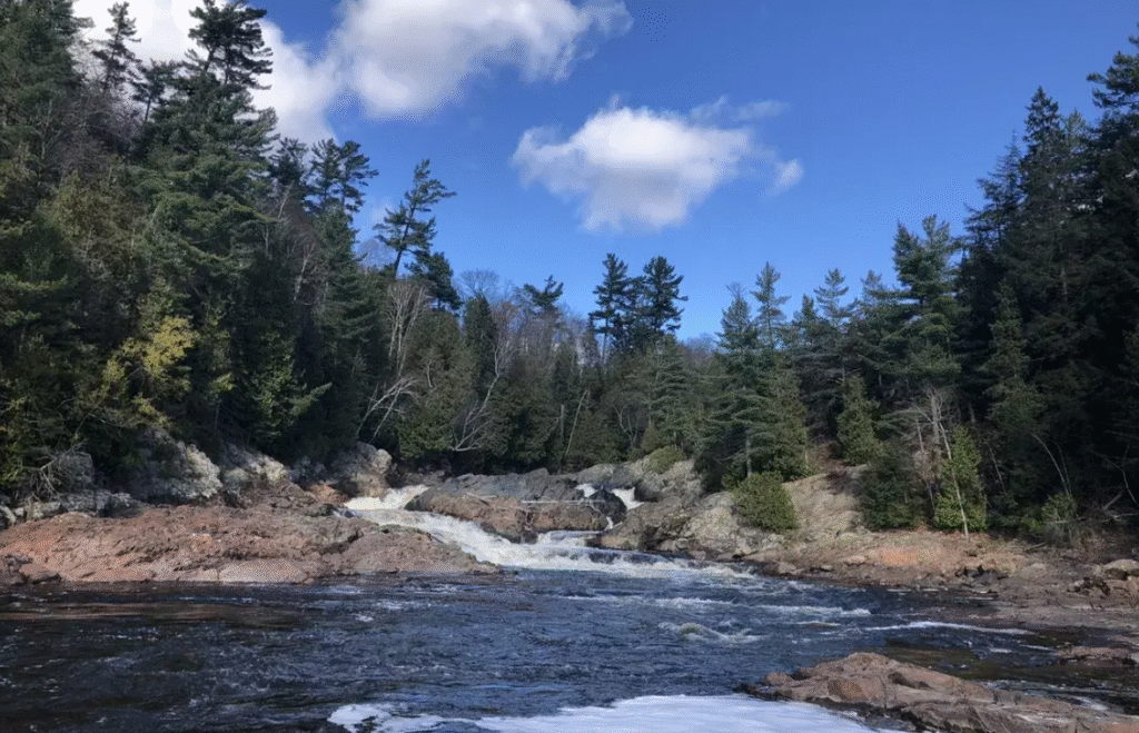
Pro Tip: Spring snowmelt provides the most spectacular flow, while fall’s lower water levels make exploration safer. Wear slip-resistant footwear as wet rocks can be extremely slippery.
Batchawana Bay Provincial Park
This day-use provincial park features Lake Superior’s warmest shallow water areas. The bay, sheltered by Batchawana Island, maintains significantly warmer temperatures than the open lake, making it ideal for family swimming. The 24-hour visitor center offers heated restrooms year-round.
Hidden History: This site served as a historic trading post for the North West Company and Hudson’s Bay Company (1817-1870) and is where the Great Lakes’ largest recorded fish was caught.
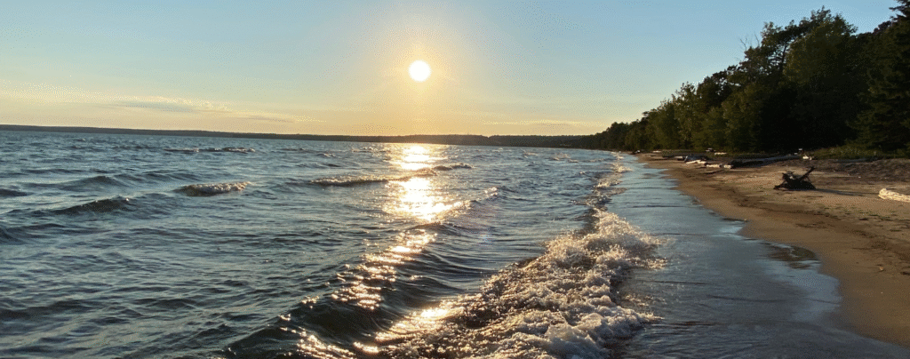
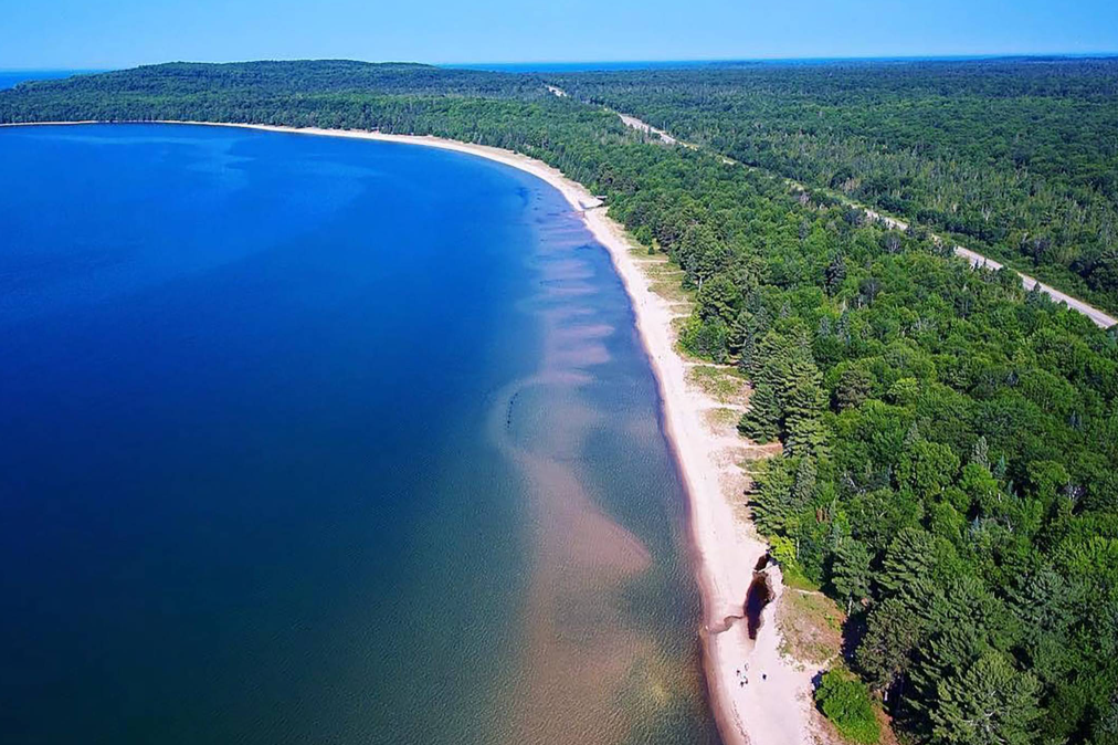
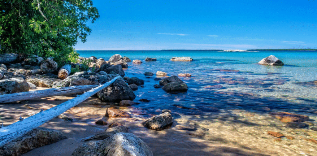
Pancake Bay Provincial Park
Featuring a 3.2-kilometer white sand beach, Pancake Bay is one of Ontario’s most beautiful beaches. The name originates from French explorers who made pancakes here during supply shortages. The park offers 325 campsites including premium waterfront sites and 5 yurts.
Budget Tip: While waterfront sites cost more, hilltop sites offer greater privacy and quiet at better prices. Sites 1-25 are radio-free zones, perfect for those seeking tranquility. Book 5 months in advance, especially for holiday weekends.
Agawa Bay Campground
The main camping area in Lake Superior Provincial Park, with over half of its 147 sites offering lake views. This dark sky preserve provides excellent stargazing conditions. The 300-series campsites are radio-free zones, ideal for travelers seeking a primitive camping experience.
Photography Secret: Excellent aurora viewing location, with September offering the best opportunities. Lakeside campsites provide unforgettable sunsets—bring a tripod for long-exposure photography.
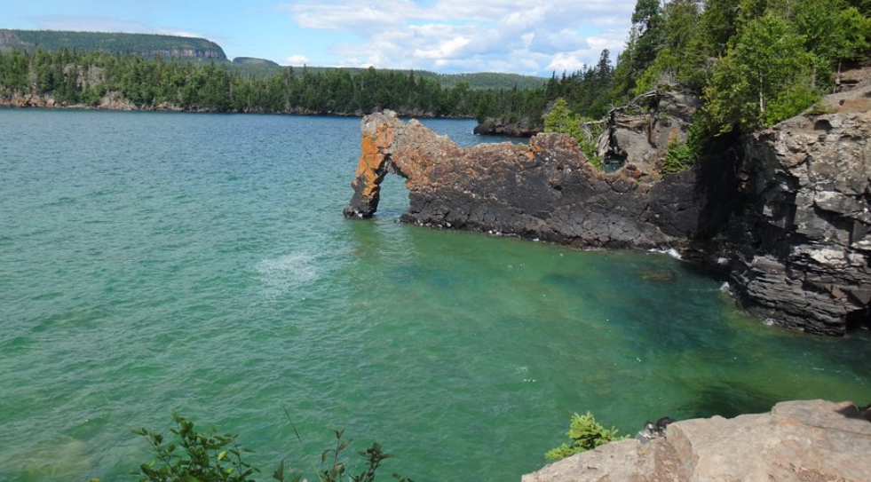
Agawa Rock Pictographs
Over 400 years old, these Indigenous pictographs feature 35 clearly visible images, with the most famous being the Mishipeshu (Great Lynx). This is one of Canada’s most significant Indigenous archaeological sites, located on crystalline granite cliffs rising 15 stories above the lake.
Safety Warning: Only visit during calm lake conditions; the sloped rocks require holding onto metal chains fixed to the cliff. On-site warning signs explicitly state “deaths and injuries have occurred”—exercise extreme caution.
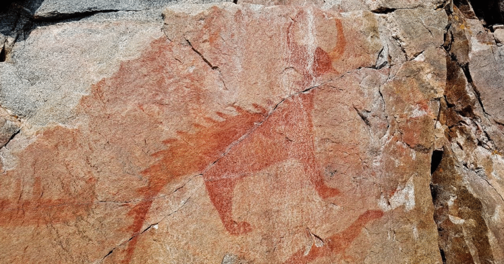
Cultural Significance: This sacred Ojibwe vision quest site features pictographs reportedly created by specific shamans Myeengun and Shingwaukonce. Please respect this sacred place—touching the pictographs is strictly prohibited.
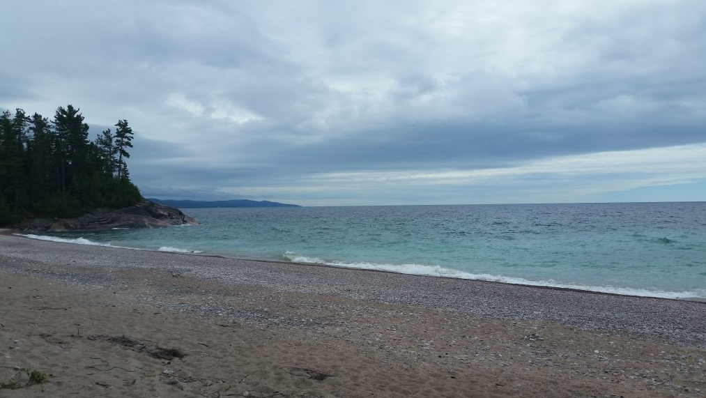
Katherine Cove
A white sand beach within Lake Superior Provincial Park, featuring clear, warm water as a designated swimming area. This is also the trailhead for the famous Bathtub Island coastal trail.
Money-Saving Tip: Limited parking fills early—arrive first thing in the morning or visit on weekdays. Never park on Highway 17 shoulders—it’s dangerous and illegal.
Middle Section Attractions (Around Wawa)
Bathtub Island
A 500-meter walk from Katherine Cove leads to this unique rock island. The natural basin-shaped depression fills with Lake Superior water when waves are high enough, creating the “bathtub” effect. The smooth Canadian Shield rocks become extremely slippery when wet—exercise caution.
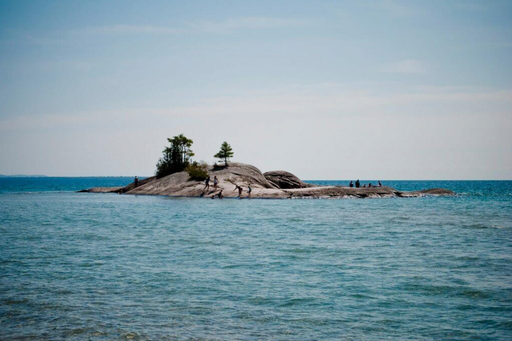
Best Time to Visit: Golden hour lighting provides optimal effects, and the view from the “bathtub” looking back toward the mainland cliffs is breathtaking. Bring water shoes and a change of clothes.
Old Woman Bay
A 3-kilometer pebble beach forming a horseshoe bay, with rock formations in the 200-meter cliffs resembling an old woman’s face. The Nokomis Trail offers a 5-kilometer loop with 3 main viewpoints.
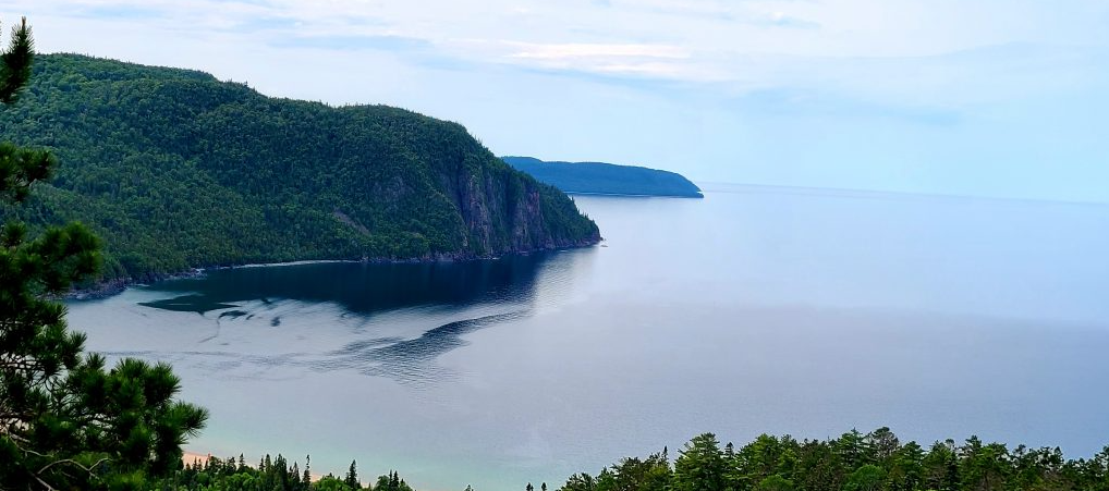
Insider Recommendation: Across from the trail is the Nokomis Trail trailhead, ranked among Canada’s top five day hikes. Fall storm-watching season offers particularly spectacular views.
Wawa Goose
The third-generation Wawa Goose, unveiled in 2017, stands 28 feet tall and 22 feet long with a 20-foot wingspan—a bronze sculpture. This is one of North America’s most photographed roadside attractions, drawing hundreds of thousands of visitors annually.
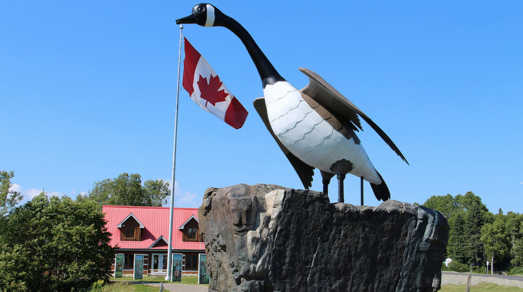
Cultural Background: “Wawa” means “wild goose” in Ojibwe. Built in 1960 to attract tourists after the Trans-Canada Highway bypassed downtown, construction cost $300,000 CAD, jointly funded by government and community.
Winnie the Pooh Memorial
The bronze Winnie statue in White River commemorates the birthplace of the real Winnie the Pooh story. On August 24, 1914, Lieutenant Harry Colebourn purchased a bear cub here, named it Winnipeg, which later became a star attraction at London Zoo and inspired A.A. Milne’s famous children’s stories.
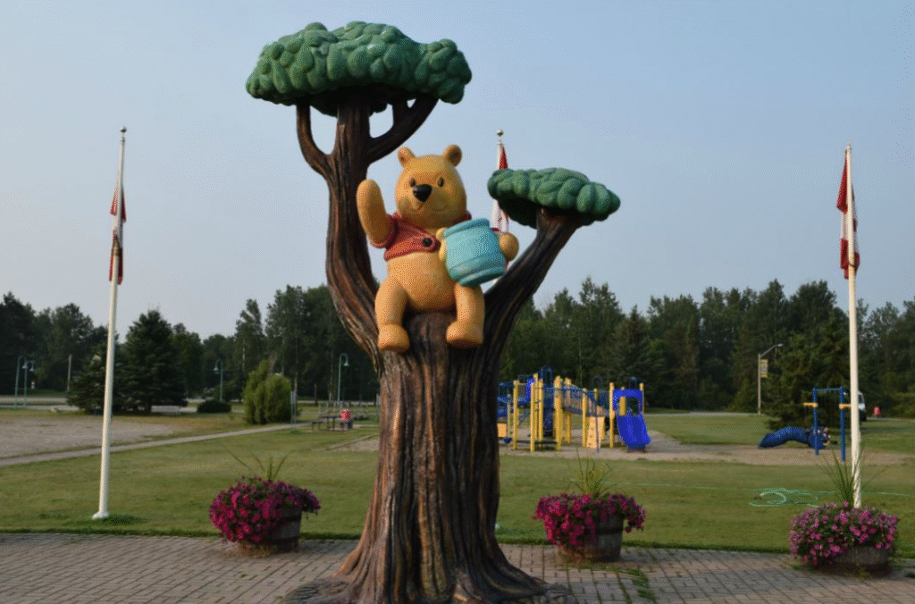
Bonus Attraction: The actual train platform where the bear cub was purchased is only 200 meters from the statue. White River also holds Canada’s record for coldest temperature (-58°F/-50°C in 1935).
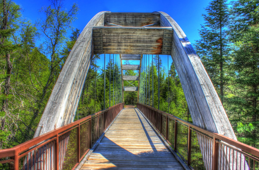
Pukaskwa National Park
Ontario’s largest national park (1,880 square kilometers) and the only one classified as wilderness. The 60-kilometer coastal hiking trail includes suspension bridges, offering the longest undeveloped shoreline experience in the Great Lakes.
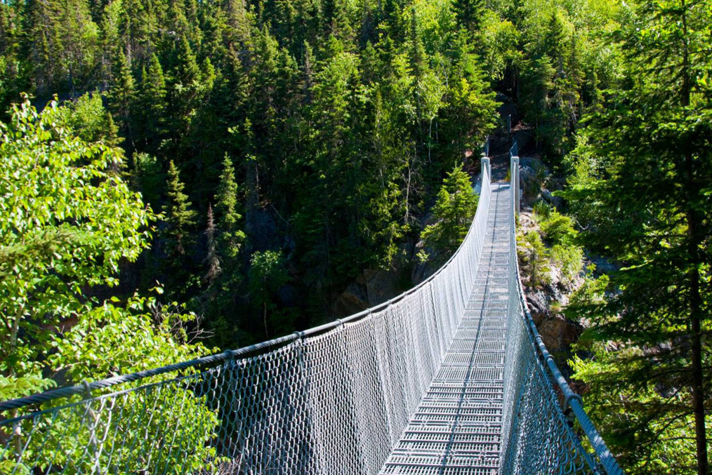
Accommodation Options: 67 first-come, first-served campsites rarely fill up. Five oTENTik glamping units cost $111-133 CAD per night. Dark sky preserve status makes this Ontario’s best aurora viewing location.
Aguasabon Falls
A 100-foot man-made waterfall created by a 1940s hydroelectric project. Water flows through a 2.6-billion-year-old granodiorite canyon, still providing hydroelectric power to Terrace Bay today.
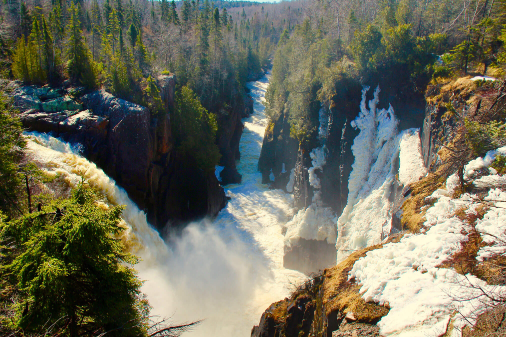
Photography Tip: Spring snowmelt (May-June) provides the most abundant flow, while winter offers spectacular ice formations. Lesser-known is the different angle of the lower falls visible from Terrace Bay beach.
Southern Section Attractions (Around Thunder Bay)
Eagle Canyon Adventures
Canada’s longest suspension bridge (600 feet/182 meters), with a second bridge at 300 feet, both suspended 45 meters above the canyon. Currently ranked as the #1 attraction on Lake Superior Circle Tour.
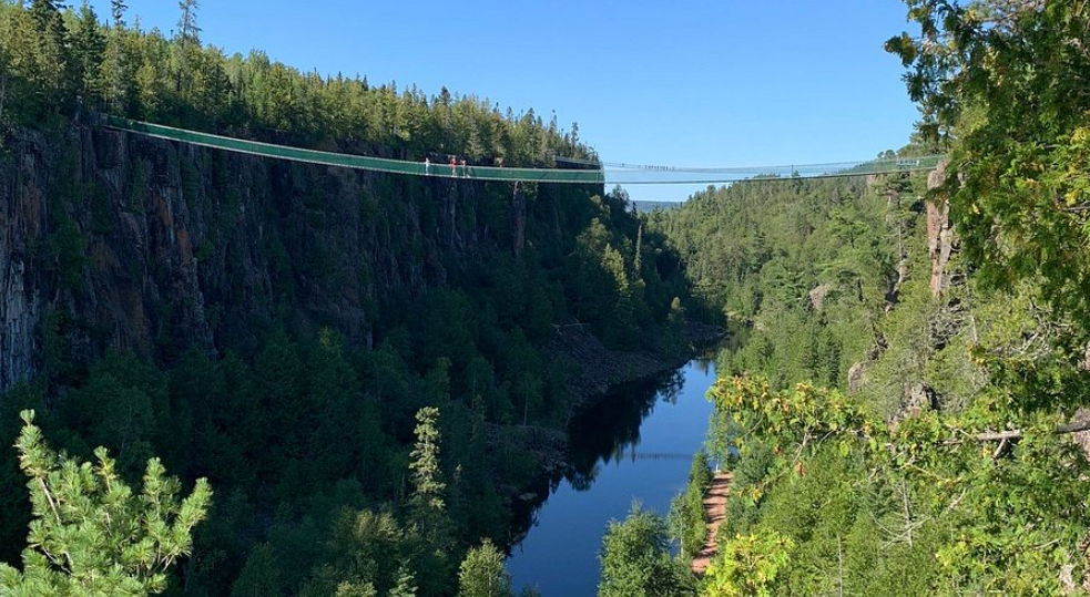
Pricing Details: Adults $23 CAD, children 4-8 years $13 CAD, under 4 free. Free shuttle service for mobility-impaired visitors. The 2.3-kilometer loop trail takes about 30 minutes, but allow 1+ hours for the full experience.
Ouimet Canyon Provincial Park
A massive canyon 150 meters wide, 100 meters deep, and 2 kilometers long with 100-meter vertical cliffs. The microclimate at the canyon bottom allows Arctic alpine plants to thrive 1,000 kilometers south of their normal range.
Accessibility-Friendly: Features wheelchair-accessible pathways directly to viewpoints. Summer mosquitoes and blackflies are prevalent—bring insect repellent.
Panorama Amethyst Mine
Canada’s largest amethyst deposit, a family-operated business since 1960. The 5-acre public digging area lets visitors experience the thrill of “dig your own amethyst.”
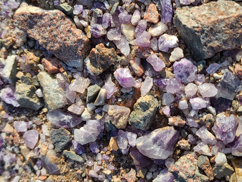
Pricing Information: Mine admission $10 CAD, amethyst priced by weight at $4-5 CAD per pound. Amethyst color ranges from pale purple to nearly black—iron content determines depth. All amethyst crystals are naturally hexagonal.
Sleeping Giant Provincial Park
244 square kilometers of protected wilderness with over 100 kilometers of hiking trails. The famous “Top of the Giant” trail is a challenging 22-kilometer return hike with spectacular views. Thunder Bay Lookout is accessible by car.
Accommodation Recommendation: Over 200 campsites and 40 backcountry sites, plus 5 rustic cabin rentals. Marie Louise Lake is better suited for novice paddlers than Lake Superior.
Silver Islet General Store
Northwestern Ontario’s oldest continuously operating store (since 1871), with historic building restoration maintaining over 150 years of heritage character. The tea room serves light meals and fresh-baked pastries, while the ice cream parlor is a summer favorite.
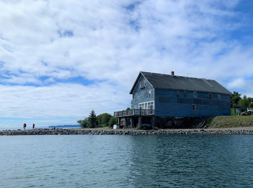
Operating Hours: Open summers, closed Wednesdays, tea room closes at 5 PM, store operates until 6 PM. The building features museum-quality historical artifacts, connecting to the nearby Sea Lion hiking trail.
Terry Fox Monument
A 9-foot bronze statue by sculptor Manfred Pervich, with a base constructed from granite and amethyst. Commemorates the 1980 Marathon of Hope, when Terry ran 5,373 kilometers before cancer recurrence forced him to stop.
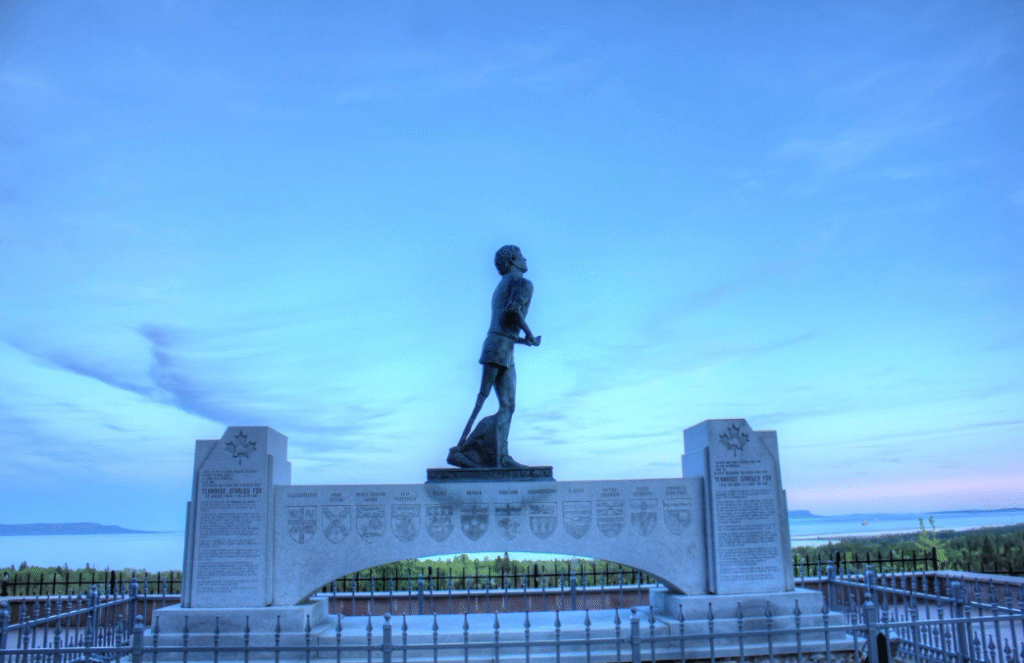
Scenic Advantage: Panoramic views overlooking Lake Superior and Sleeping Giant make this an excellent starting or ending point for the Circle Tour. The visitor center offers free Wi-Fi, clean restrooms, and charging stations.
💡 Essential Pre-Trip Information (Itinerary Planning + Transportation)
Best Travel Season: July-September is the ideal period, with warm weather and all facilities fully operational. July-August is peak season with higher prices but most complete services. The shoulder seasons of May-June and September-October offer affordable prices and fewer crowds, though some facilities may have reduced hours or be closed.
Recommended Trip Duration:
- 2-3 days: Quick tour of main highlights
- 4-5 days: Thorough experience of key attractions
- 6-7 days: In-depth exploration including hiking activities
Vehicle Rental Advice: Choose a small SUV or hatchback with fuel efficiency around 6.1L/100km. Compact sedans handle the good highway conditions fine, but AWD vehicles have advantages at some sandy beach campsites.
Navigation Tools: Download offline maps—essential. Recommend Maps.me or Google Maps offline function. The Ontario 511 app provides real-time road condition information.
🏕️ Accommodation and Camping Recommendations
Provincial Park Campground Ratings:
- Pancake Bay Provincial Park: Most popular, requires 5-month advance booking. Waterfront sites offer spectacular views but cost more; recommend radio-free sites 1-25.
- Lake Superior Provincial Park: Agawa Bay Campground has over half of sites with lake views; 300-series sites are radio-free zones.
- Pukaskwa National Park: First-come, first-served policy, rarely full. Five glamping units provide more comfortable experiences.
Lodging Recommendations:
- Wawa: Mystic Isle Motel ($120+ CAD/night, highly rated)
- Terrace Bay: Drifters Motel (rustic elegance with excellent on-site restaurant)
- Thunder Bay: Rich variety from budget to luxury options ($80-300+ CAD/night)
Unique Accommodation Experiences:
- Pancake Bay Yurts: Accommodate 6 people, equipped with bunk beds, table, and mini-fridge
- Crown Land Free Camping: Near Pancake Bay and other locations offer 21-day limit free camping
📋 Important Considerations (Safety and Packing List)
Wildlife Safety:
- Black Bears: Present throughout the region, never feed them, store food in bear-proof containers or vehicles
- Moose: Highway hazards, especially at dusk and dawn
- Backcountry Camping: Hang food 10 feet off the ground
Weather Preparation: The Lake Superior effect causes rapid weather changes—bring warm clothing even in summer. Lakeside temperatures are cooler than inland areas, requiring layered clothing.
Communication and Emergency Contacts:
- Emergency Number: 911 (satellite phone dial 867-920-0911)
- Major Hospitals: Sault Area Hospital, Thunder Bay Regional Health Sciences Centre
- OPP Detachments in: Sault Ste. Marie, Wawa, Marathon, Nipigon, Thunder Bay
Essential Packing List:
- Summer: Layered clothing, rain gear, warm clothes, sun protection, insect repellent
- Year-Round: First aid kit, flashlight, extra batteries, offline maps, emergency food and water
- Recommended: Bear spray (where permitted), satellite communicator
Reminder: Bear spray has carrying restrictions in some provincial parks or public buildings. Check regulations before use.
💰 Budget Considerations (Money-Saving Tips Revealed)
Daily Budget Estimates (2024):
- Budget: $90-120 CAD per person daily
- Mid-Range: $150-200 CAD per person daily
- Luxury: $250+ CAD per person daily
Fuel Costs: Round trip in a compact car approximately $150-200 CAD. Use the GasBuddy app to find cheapest stations. Alberta has lowest prices; Vancouver highest.
Money-Saving Strategies:
- Choose camping over hotels: Save $100+ CAD per night
- Purchase seasonal park passes: Better value for multiple parks ($84.75 CAD)
- Bring your own food and drinks: Use coolers to prepare meals
- Crown Land free camping: Completely free but limited facilities
- Travel shoulder season: May-June and September-October more affordable
- Accommodation packages: Many properties offer meal and activity bundle deals
Park Entry Fees (2024):
- Day-Use Vehicle Permit: $12.25-18 CAD
- Ontario Seniors (65+): $9.75 CAD (20% discount)
- Annual Pass: $140 CAD (valid January-December)
- Camping fees include day-use privileges
🌟 Insider Perspective: Overlooked Hidden Highlights
1. Seasonal Unique Experiences:
- September Aurora: Pukaskwa National Park and Agawa Bay Campground are Ontario’s best aurora viewing spots—rarely mentioned in most guides
- Winter Ice Falls: Aguasabon Falls forms spectacular ice formations in winter with stunning photography potential
- Spring Wildflowers: May-June at Ouimet Canyon, Arctic alpine plants bloom 1,000 kilometers south of their normal range—a natural miracle
2. Free Alternatives:
- Crown Land Camping: Legal free camping areas near Pancake Bay and other locations save $40+ CAD per night in campground fees
- Beach Alternatives: Terrace Bay beach offers free views of Aguasabon Falls’ lower section from a different angle than the paid viewpoint
3. Cultural Deep Dives:
- Indigenous Cultural Camps: Pukaskwa National Park’s Anishinaabe Cultural Camp regularly hosts drum circles and Indigenous cultural activities
- Group of Seven Connection: Multiple sites were Group of Seven painting locations, including Chippewa Falls’ “Algoma Moment” easel display
4. Practical Travel Insights:
- Best Photography Times: Bathtub Island’s golden hour lighting is optimal, but most visitors arrive at noon and miss the best light
- Avoid Crowds Secret: The Nokomis Trail across from Old Woman Bay is ranked among Canada’s top five day hikes yet sees few visitors
❓ FAQ (Frequently Asked Questions)
What new infrastructure improvements were made in 2024?
Ontario has invested billions of dollars in recent years upgrading northern and Trans-Canada Highway infrastructure, including bridge maintenance, paving, snow removal, and safety facilities. However, “billions of dollars invested” represents the total for various transportation projects, not exclusively for the Lake Superior Highway 17 section. The province has implemented a 12-hour snow removal standard, ensuring major highways are cleared within 12 hours after snowfall, enhancing driving safety.
Which attractions are suitable for children?
Batchawana Bay and Katherine Cove are ideal for children due to their warm, shallow waters and gradual sandy beaches. The Wawa Goose and Winnie the Pooh Memorial are classic family photo spots. Pancake Bay Provincial Park features children’s playground equipment and beaches, perfect for family outings.
What’s the best photography season?
September-October is the golden season for fall colors, with spectacular lakeside maple foliage. July-August offers the bluest lake water, ideal for beach and water activity photography. September’s longer nights and cooler weather make it prime aurora viewing and photography time, especially at Pukaskwa National Park and Agawa Bay Campground.
How’s the cell phone coverage?
Most areas outside major towns have weak or no cell coverage, particularly with providers like Fido and Public Mobile having limited range. Download offline maps (Google Maps or Maps.me) and consider carrying a satellite communicator for emergencies.
Is winter travel worthwhile?
November-March presents severe driving conditions with heavy snowfall, ice, and poor visibility, plus most facilities are closed or day-use only. For experienced winter travelers, ice formations (like Aguasabon Falls) are highly attractive, but typical travelers should choose summer-fall seasons for safer, more convenient visits.
How much time does this journey require?
Sault Ste. Marie to Thunder Bay is approximately 703 kilometers, taking about 7.5 hours of straight driving, but recommend allocating 2 to 7 days to fully experience attractions along the way. First-time visitors should plan at least 4-5 days to thoroughly enjoy natural and cultural highlights.
What are the most important safety considerations?
The 150-kilometer stretch between Pancake Bay and Wawa with no gas stations is the biggest self-driving risk—fill up beforehand. Moose and black bears commonly appear roadside, especially at dusk and dawn, requiring heightened alertness and reduced speeds.
Which season is best to visit?
July-September offers warm weather and fully operational facilities—the best travel season. September-October features spectacular fall colors and more affordable accommodation, though some facilities may have reduced hours.
Do campgrounds require advance booking?
Popular campgrounds like Pancake Bay Provincial Park require months-advance booking during peak season. Pukaskwa National Park operates on first-come, first-served basis and rarely fills up. Plan peak season (July-August) trips well in advance.
How much does one-way fuel cost?
For compact cars, one-way fuel costs approximately $75-100 CAD (fluctuating based on fuel consumption and 2024 gas prices). Use apps like GasBuddy to find the cheapest stations along the route.
What about cell phone signal?
Most areas outside major towns have unstable or no coverage. Download offline maps before departure and carry a satellite communicator if necessary. Call 911 for emergencies.
What type of vehicle is suitable?
Regular sedans handle good highway conditions fine. For sandy or remote campgrounds, small SUVs or AWD vehicles have advantages, but 4WD isn’t essential.
What are the free attractions?
Chippewa Falls, Wawa Goose, Winnie the Pooh Memorial, Terry Fox Monument are all free attractions. Crown Land camping is also free but has limited facilities.
Where are food supply points?
Major towns including Sault Ste. Marie, Wawa, Marathon, Terrace Bay, White River, and Thunder Bay all have supermarkets and restaurants. Bring some provisions for remote sections.
What are the best photography spots?
Agawa Rock Pictographs, Bathtub Island, Old Woman Bay, Eagle Canyon suspension bridge, and Ouimet Canyon are photography enthusiast favorites.
How pet-friendly is the route?
Most provincial parks allow leashed pets, but some beaches or recreation areas have restrictions. Check individual attraction pet policies in advance.
Souvenir shopping recommendations?
Silver Islet General Store has historical memorabilia, Panorama Amethyst Mine offers self-collected amethysts, and Wawa and White River visitor centers stock local specialty products.
Best accommodation choices?
Budget travelers can choose camping; those seeking comfort can consider Wawa’s Mystic Isle Motel or Terrace Bay’s Drifters Motel. Thunder Bay offers diverse lodging options.
How difficult are the hikes?
Ranging from easy (Katherine Cove beach trail) to difficult (22-kilometer Top of Sleeping Giant). Most trails suit average fitness levels; some challenging routes require proper equipment and experience.
What about emergencies?
Call 911; major medical facilities are in Sault Ste. Marie and Thunder Bay. Carry a first aid kit and emergency contact information, and plan contingencies in advance.
🚀 The Magnificent Scenery and Endless Adventure of Highway 17 Along Lake Superior
Highway 17 along Lake Superior, as a vital segment of the Trans-Canada Highway, has been lauded by numerous travel websites and journals as a world-class driving experience. This route hugs the spectacular Lake Superior shoreline, featuring pristine forests, cliffs, beaches, waterfalls, and unique geological formations, offering breathtaking natural beauty in all seasons and weather conditions.
Travelers universally agree that this highway offers not only magnificent scenery but also rich Indigenous culture and Canadian history—from Chippewa Falls and Agawa Rock Pictographs to the Wawa Goose and Terry Fox Monument, every stop deserves careful appreciation. Whether visiting for the first time or returning, you’ll discover new highlights each trip. Many hidden trails, viewpoints, and small towns reveal their secrets only through personal exploration.
Experts and local travelers recommend: don’t treat this section merely as a transportation route—approach it with an open mind, ready to stop anytime to appreciate lakeside scenery, photograph, hike, or chat with locals. The most beautiful scenery often lies beyond plans, which is precisely Highway 17’s charm along Lake Superior.
If you enjoyed this guide, please share it with adventure-loving friends. Wishing you abundant memories and unforgettable experiences on your Lake Superior lakeside road trip!